


DECEMBER 10, 2020
India’s desi-GPS is now in the same league as the US, Russia and China — can scan 1,500 kilometres beyond its own border. – ISRO
India’s own indigenous navigation system has hit a new milestone. The Navigation with Indian Constellation (NavIC) is now in league with the US, China, and Russia as a recognised component of the World-Wide Radio Navigation System (WWRNS).
After two years of waiting in line, approval was finally announced by the International Maritime Organisation (IMO) during its 102nd session hosted virtually between November 4 to November 11. IMO is a specialized agency under the United Nations (UN).
The Indian government has also invited proposals for the manufacturer of a million receiver chips that have GPS and NavIC. The aim is to only improve the overall signal availability of navigation systems, but also increase the use of its own desi-GSP.
Not only is this a significant achievement for India but also for the Ministry of Ports, Shipping and Waterways (MoPSW), Directorate General of Shipping (DGS), and Indian Space Research Organisation (ISRO).
What is NavIC?
The Indian Regional Navigation Satellite System (IRNSS), more popularly known as NavIC, is designed to provide accurate and timely positional information to assist with the navigation of ships.
The initiative was launched after the US refused to give India crucial GPS information during the Kargil war in 1999.
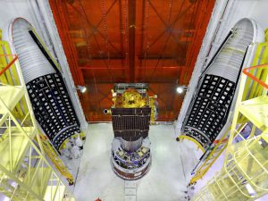
It is powered by a constellation of seven satellites, all of which are positioned around 36,000 kilometres from Earth.
In comparison, Russia has 26 satellites powering its Global Navigation System (GLONASS). China’s BeiDou Navigation Satellite System (BDS) has plans to expand to a total of 35 satellites to cover the world.
Europe’s Galileo system, which began operations in 2016, has a constellation of 30 satellites powering its navigation.
Who can use NavIC?
The navigation system provides two kinds of services, the Standard Positioning Services (SPS) and Restricted Service (RS).
SPS can be used for all navigation needs. RS, however, is an encrypted service only available to authorized users, like security agencies.
What can NavIC be used for?
NavIC can provide positional accuracy of better than 20 metres to help with things like marine navigation, which was its primary objective, as well as disaster management, vehicle tracking, navigation for hikers and travelers and voice navigation for drivers.
Last year, it got approved by the global standards body 3GPP, which is responsible for coordinating global standards for cellphones. This opens up the system for commercial use by mobile manufacturers like Samsung, Apple and others.
Qualcomm, one of the largest chip makers in the world, has already manufactured NavIC-capable chipsets that are being used by RealMe and Xiaomi in their handsets.
If applied across India, NavIC holds the potential to replace the US-owned Global Positioning System (GPS) in the Indian Ocean and can cover areas up to 1,500 kilometres beyond India’s geographical boundaries.
Courtesy/Source: Business Insider – INDIA


