


SEPTEMBER 11, 2018
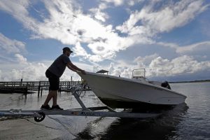
Nick Hobbs, of Marine Warehouse Center, removes a customer’s boat from the water in advance of Hurricane Florence in Wrightsville Beach, N.C., Tuesday, Sept. 11, 2018. Florence exploded into a potentially catastrophic hurricane Monday as it closed in on North and South Carolina, carrying winds up to 140 mph (220 kph) and water that could wreak havoc over a wide stretch of the eastern United States later this week. – (AP Photo/Chuck Burton)
The National Hurricane Center issued its first set of Hurricane and Storm Surge Watches Tuesday for the East Coast as Hurricane Florence continues its trek toward North Carolina.
The “extremely dangerous major hurricane” is predicted to hit the coast late Thursday or early Friday morning, dropping as much as 30 inches of rain in some areas and wind gusts in the 140 mph range, says the National Hurricane Center.
Part of the danger may come later in the week, due to increased fears Florence “will slow considerably or stall, leading to a prolonged and exceptionally heavy and dangerous rainfall event Friday-Sunday,” says the Center on Tuesday.
As of 11 a.m. Tuesday, Hurricane Florence had maximum sustained winds of about 130 mph, a slight weakening from earlier the morning. Be the first to know.
“Florence is expected to begin re-strengthening later today and continue a slow strengthening trend for the next day or so,” said the National Hurricane Center update.
“While some weakening is expected on Thursday, Florence is expected to be an extremely dangerous major hurricane through landfall.”
Both the Hurricane and Storm Surge Watches cover the area from Edisto Beach, South Carolina, north to the North Carolina-Virginia border, according to a statement issued Tuesday.
A Storm Surge watch means the possibility of “life-threatening inundation from rising water moving inland” over the next 48 hours.
“Additional watches may be required later today,” said the National Hurricane Center, warning inland areas have as much to worry about as the coast.
“The combination of storm surge and the tide will cause normally dry areas near the coast to be flooded by rising waters moving inland from the shoreline.”
The water could rise 6 to 12 feet in the area of Cape Fear to Cape Lookout, including the Neuse and Pamlico rivers, says the National Hurricane Center. Cape Lookout to Ocracoke Island could see 5 to 8 feet of water, experts say.
A “probable” track of Hurricane Florence continues to show the storm hitting the North Carolina coast, though it appears landfall is edging north of Wilmington toward the Outer Banks, according to the latest maps issued by the National Weather Service.
Hurricane Florence was upgraded to a category 4 Hurricane Monday morning and it continues to build in size, strength and speed, says the National Hurricane Center.
It is currently moving west-northwest at about 16 mph and that speed is expected to increase in the next few days, says the center.
As of Tuesday morning, hurricane force winds were extending up to 40 miles from the storm’s center and “tropical storm force winds” were showing up as far away as 150 miles, said the National Weather Service.
Category 4 hurricane winds are in the 130 to 156 mile range, according to the National Hurricane Center.
The center is predicting “tropical force winds” — in the 39 to 73 mph range — would reach the coast by late Wednesday and move inland within 24 hours.
On Tuesday, the National Hurricane Center tweeted that predictions for maximum wind gusts that showed Jacksonville, Emerald Isle and North Topsail Beach could see gusts from 125 to 144 mph as the storm moves ashore.
Nearby Jones County could see gusts in the 100 mph range, while neighboring counties will be in the 60 to 95 mph range, officials said.
Hurricane #Florence is not just a threat to the coast. Very heavy, prolonged rainfall is expected over a large portion of the Carolinas and mid-Atlantic. Here is the latest 7 day rainfall forecast from @NWSWPC. pic.twitter.com/HVMCOMDQIr
— National Hurricane Center (@NHC_Atlantic) September 10, 2018
“Florence is expected to produce total rainfall accumulations of 15 to 20 inches with isolated maximum to 30 inches near Florence’s track over portions of North Carolina, Virginia, and northern South Carolina through Saturday,” says the National Hurricane Center. “This rainfall could produce catastrophic flash flooding and significant river flooding.”
Evacuations of coastal North Carolina began at noon Monday, with Dare County officials calling for the entire county to evacuate. Other counties are evacuating low lying and flood prone areas. South Carolina is also seeing a mass exodus, after the state’s governor ordered a mandatory evacuation of the coastal counties.
Hurricane #Florence is not just a threat to the coast. Very heavy, prolonged rainfall is expected over a large portion of the Carolinas and mid-Atlantic. Here is the latest 7 day rainfall forecast from @NWSWPC. pic.twitter.com/HVMCOMDQIr
— National Hurricane Center (@NHC_Atlantic) September 10, 2018
Courtesy/Source: The Charlotte Observer


