


January 23, 2015
HARTFORD, Conn. — A fast-moving coastal storm is forecast to blast several major cities in the Northeast with a mix of snow, sleet and rain on Saturday in the season's first real taste of winter along the busy Interstate 95 corridor.
January 23, 2015
HARTFORD, Conn. — A fast-moving coastal storm is forecast to blast several major cities in the Northeast with a mix of snow, sleet and rain on Saturday in the season's first real taste of winter along the busy Interstate 95 corridor.
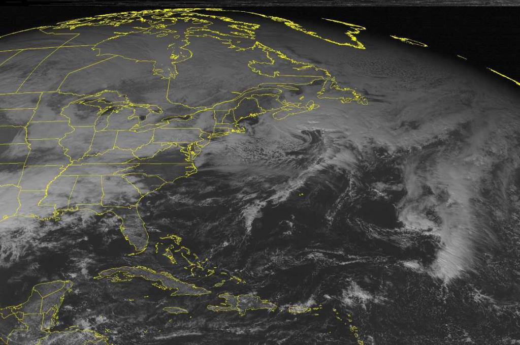
This NOAA satellite image taken Thursday, Jan. 22, 2015 at 12:45 p.m. EST, shows a storm system over the Atlantic Ocean with a back-end surface trough that is causing some snow to develop across parts of southern New England. A larger developing storm system is located just due northwest of the Gulf of Mexico with a large precipitation shield over most of the Lower Mississippi River Valley. This system is expected to impact New England later this week.
The biggest snowfall amounts are expected in southern New England, but forecasters warned that temperatures hovering near freezing could make for slippery driving conditions across the region.
"It's kind of the first one, so it's a good thing it's happening this weekend," National Weather Service meteorologist Bill Simpson in Taunton, Massachusetts, said Friday. "If this happened during a weekday, it could be really slow and messy."
As it sweeps northeast along the Eastern Seaboard, the storm is expected to drop 1 to 4 inches of snow and ice in Philadelphia on Saturday morning before turning over to rain. It is forecast to bring 3 to 4 inches of snow to New York City and 4 to 6 inches to Boston, with higher amounts in central Massachusetts, before moving out to sea by early Sunday.
After a relatively tame start to the winter, Connecticut has plenty of salt and snow-treatment chemicals stockpiled around the state and a fleet of 632 plow trucks ready to go, Department of Transportation spokesman Kevin Nursick said. He said crews have been pre-treating some highways and bridges, but there already is some salt leftover from recent, smaller storms.
"We don't need to go full tilt," he said.
The storm is expected to begin as snow across much of the region, with areas east of I-95 receiving mostly rain. Forecasters say accumulation amounts will depend on how quickly the rain line moves west. The weather service said the Philadelphia area could receive as much as a quarter-inch of ice Saturday morning before the rain arrives.
Meteorologist Peter Wichrowski in Upton, New York, said snow likely would start to fall in New York City in the early morning hours of Saturday, with a mix of rain and maybe a little sleet along the coastal areas. He said snowfall totals were expected to be around 1 to 2 inches across eastern Long Island.
Baltimore and Washington were expected to get only rain as temperatures hover just above freezing.
Courtesy: AP


