October 21, 2016
A dramatic change to colder weather, and in some cases a taste of winter with snow, will take place into this weekend following summerlike conditions in the northeastern United States.
October 21, 2016
A dramatic change to colder weather, and in some cases a taste of winter with snow, will take place into this weekend following summerlike conditions in the northeastern United States.

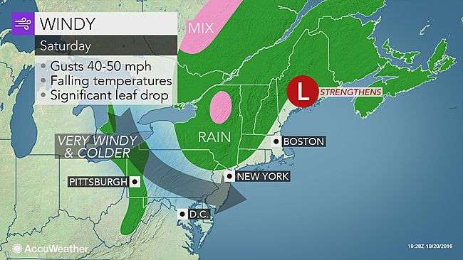
The colder air was making slow progress across the Midwest prior to the end of the week. However, the cold push will accelerate and reach the Appalachians during Friday night and then the Atlantic Seaboard on Saturday.
Shorts and short-sleeve weather will be replaced by conditions requiring long-sleeves and layered clothing, including coats, hats and even gloves, for those spending time outdoors at area football games.
Some people may have to put their heat on for the first time this season. For those heating with firewood, be sure to bring wood in ahead of the rain to keep it dry.
Record-challenging high temperatures in the 70s and 80s F will be replaced by highs in the 40s and 50s.
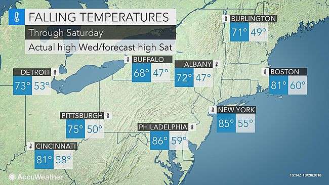
Nighttime lows will be in the 30s and 40s with gusty wind during the first part of the weekend.
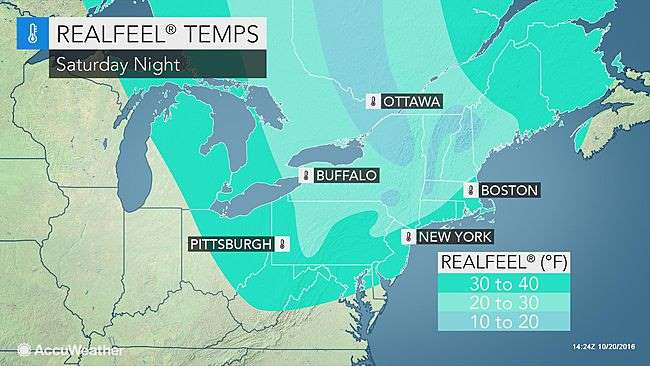
When factoring in AccuWeather RealFeel® Temperatures, it will feel 40 to 50 degrees colder, coming off the record warmth in many places. RealFeel Temperatures will be 10 to 20 degrees lower than the actual temperature by Saturday night.
"A quick dose of drenching rain and locally gusty thunderstorms will mark the leading edge of the colder air," according to AccuWeather Chief Meteorologist Elliot Abrams.
A few locations could be hit by a thunderstorm with brief severe weather. In parts of upstate New York as well as northern and eastern New England, enough rain could fall to cause urban flooding. This can occur regardless of prior drought conditions.
The fall foliage may take a hit from the change to colder weather.
"Blustery conditions may knock a lot of leaves off the trees, so the foliage may not be as vibrant in the wake of the event," according to AccuWeather Meteorologist Brian Lada.
Where leaves fall with the rain, some roads could be extra slick. Fallen leaves can also block storm drains and add to the risk of urban flooding.
The cold air will sweep in quickly in portions of upstate New York and northwestern New England. In these areas, the cold air will catch up to the back edge of the rain, causing the first accumulating snow of the season.
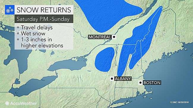
"Up to a few inches of snow can fall over the higher terrain and non-paved areas of the Adirondack, Green and White mountains from Saturday afternoon into Sunday morning," according to AccuWeather Senior Meteorologist Brian Wimer.
A few wet snowflakes or a dash of sleet can mix in over the higher terrain of the Alleghenies, Catskills, Poconos, Berkshires and Endless mountains for the first time this season.
Winds will ease, sunshine will return and temperatures will rebound a bit on Sunday afternoon in all but the northern parts of New York state and New England. Highs will be mainly in the 50s and 60s.
"A reinforcing push of cold air could bring a frost and freeze to some locations of the Northeast during next week," Abrams said.
Some areas untouched by frost so far this season in the mid-Atlantic could be reached during the middle part of next week.
The secondary push of cold air will sweep southeastward from Canada on Monday. There could be some wet snow mixed in with rain showers in parts of New York state and New England.
Courtesy: AccuWeather


